Scenic Backroads, White Mountains – I have been traveling the backroads of New Hampshire for many years, and always find interesting subject matter along them to photograph. From a photographer's viewpoint, I find autumn to be the best time to explore them. And the history attached to some of these roads is amazing.
Many of the backroads in the White Mountains are one lane dirt roads, and some such as Sandwich Notch Road are very rough, and only high clearance vehicles should attempt to drive these roads. Because not everyone is interested in hiking to a scenic location, here are a few backroads that are worth exploring.
Completed in 1934, Tripoli Road (above) connects Waterville Valley and Woodstock. The Woodstock side of the road utilizes parts of the old Woodstock & Thornton Gore Railroad (1909-1914). Along Tripoli Road is the site of the Thornton Gore Hill Farm community, a farming settlement abandoned in the 19th century. Remnants of the old Tripoli Mill, which dredged East Pond for diatomaceous earth during the early 1900s can be found along the road. And a Civilian Conservation Corps Camp was also located along the road.
In Woodstock, New Hampshire off Route 118 is Elbow Pond Road (above). This road also utilizes parts of an old logging railroad, the Gordon Pond Railroad (1907-1916 ). Elbow Pond Road is a dirt road that leads to the scenic Elbow Pond. During peak autumn foliage, Elbow Pond looks incredible.
When it comes to historical backroads in the White Mountains, Sandwich Notch Road (above) is at the top of the list. Established in 1801, the Notch Road is a 9 mile east–west, one lane, dirt road in Thornton and Sandwich. During the early nineteenth century, Sandwich Notch Road was what Interstate 93 is to us today. This is a very rough road, and it is recommended that only high clearance vehicles travel it.
Jefferson Notch Road begins off Base Road in Crawford's Purchase. It travels through Chandler's Purchase, Thompson and Meserve's Purchase (above), and Low and Burbank's Grant, and eventually ends at Valley Road in Jefferson. Built in 1901-1902, the purpose of the Jefferson Notch Road, known as Jefferson Notch Highway in the early days, was to connect the Crawford House with Jefferson Highlands. Along this dirt road is the highest elevation reached by a public highway in New Hampshire.
One of my favorite backroads to explore during the autumn foliage season is Sawyer River Road (above) in Hart's Location and Livermore. Located off of Route 302, this dirt road is in Sawyer River Railroad territory (1877-1928), and the historic logging ghost town of Livermore is along it.
If you decide to explore any of these backroads, keep in mind, they are seasonal roads. And they are usually closed on the first significant snowfall. All of the above images can be licensed for publications by clicking on the image you are interested in, and you can view more images of backroads here.
Happy image making..
If you want to know the status of any forest road, go directly to the source – Forest Service: White Mountain National Forest Forest Roads Status Information
Connect with us on Facebook | Historic Information Disclaimer | White Mountains History
Owner of ScenicNH Photography LLC
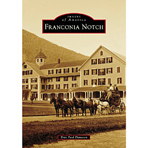
Erin Paul is a professional photographer, writer, and author who specializes in environmental conservation and historic preservation photography mainly in the New Hampshire White Mountains. His work is published worldwide, and publication credits include: Appalachian Mountain Club, Appalachian Trail Conservancy, Backpacker Magazine, and The Wilderness Society. He has written two photo history books about the White Mountains: the East Branch & Lincoln Railroad (2018) and Franconia Notch (2024).


ScenicNH Photography LLC
Specializing in environmental conservation and historic preservation photography mainly in the White Mountains region of New Hampshire, Erin Paul’s photography and writing focuses on the history of the White Mountains, and telling the story of abandoned places and forgotten historical sites.